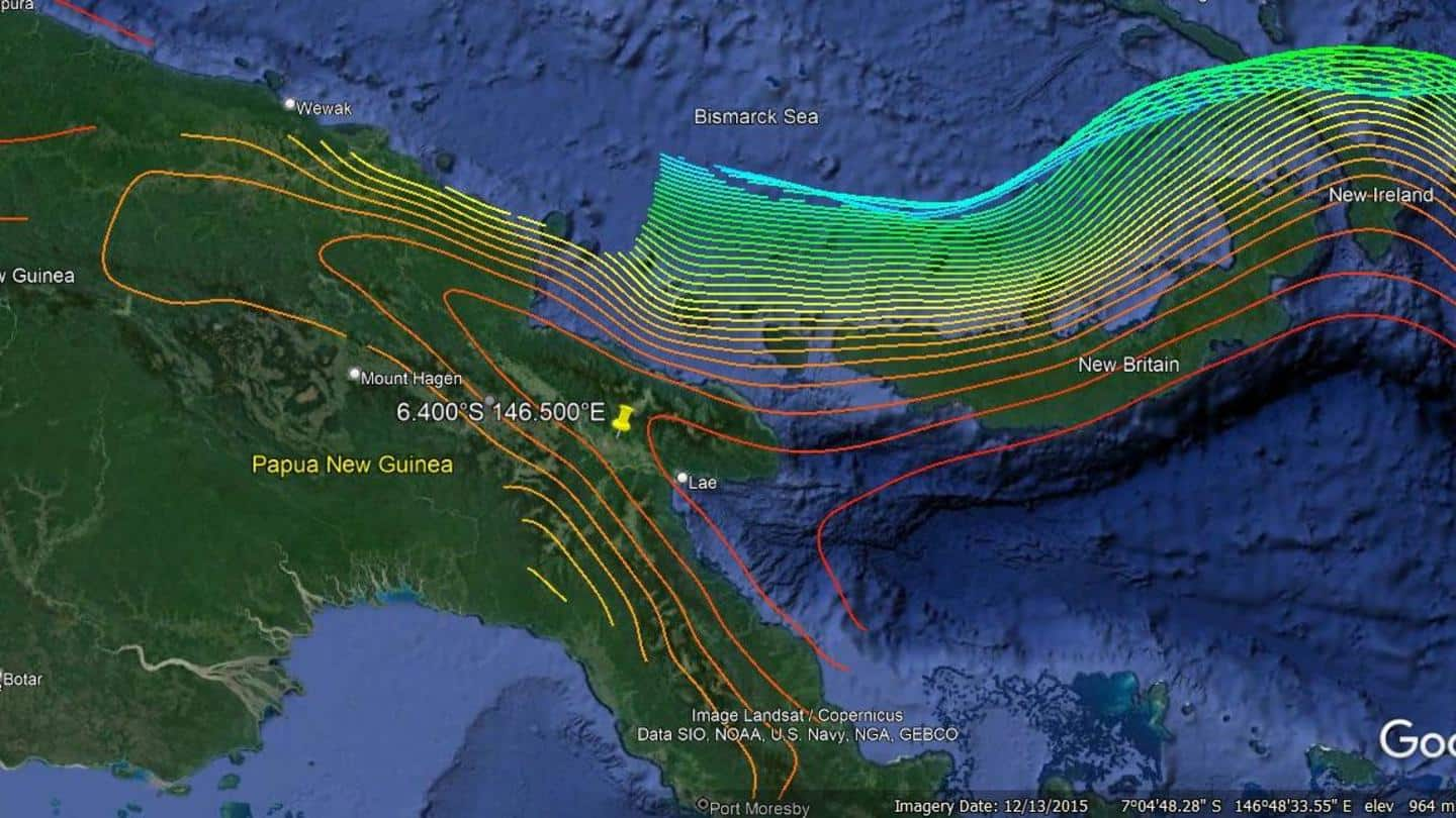
7.6 magnitude earthquake rocks eastern Papua New Guinea
What's the story
An earthquake of magnitude 7.6 hit eastern Papua New Guinea on Sunday morning which caused landslides, cracked up roads, and damaged buildings in the coastal town of Madang. Although initially cautious, the US Geological Survey (USGS) later reported that there was no threat of a tsunami. No casualties have been reported so far, as per the National Oceanic and Atmospheric Administration (NOAA).
Context
Why does this story matter?
Papua New Guinea is located in the Pacific Ocean near the 'Ring of Fire' which is prone to frequent earthquakes and volcanic eruptions. The epicenter was 67 kilometers away from Kainantu town and it struck at a depth of 61 km. A 7.6-magnitude on the Richter scale is considered a "very strong" earthquake, having the potential to severely destroy life and property.
Twitter Post
Effects of earthquake were reported further inland
At around 9: 46 am (PNG Time) an earthquake of 7.6 Magnitude hits Eastern part of PNG🇵🇬
— Seismology Fiji (@FijiSeismology) September 11, 2022
) Images of soil and ground liquefaction forming in Papua New Guinea.
2) Visible damages on roads and soil of cracks and lifting formed.
Source: PNG News and Current Affairs pic.twitter.com/aI9cb6fJ6o
Details
Tsunami warning retracted later
Kainantu is a sparsely populated town of roughly 8,500 people, according to the USGS. Earlier, the US National Tsunami Warning Center had said that "hazardous" tsunami waves could occur within 1,000 km along the coasts of Papua New Guinea and its adjacent islands of Indonesia, however, it later nullified the warning. The latitude of the earthquake was 6.224°S and the longitude was 146.471°E.
Twitter Post
The video shows windows falling, large cracks appearing in walls
BREAKING: University of Goroka damaged as massive 7.7 magnitude earthquake hits Papua New Guinea pic.twitter.com/rF6h8ML4Xq
— Insider Paper (@TheInsiderPaper) September 11, 2022
Indonesia
At least four inland earthquakes jolted Indonesia's West Papua
On Saturday, a series of earthquakes rocked West Papua — the easternmost province of Indonesia which shares half of the island with Papua New Guinea. The Indonesian Meteorology, Climatology, and Geophysics Agency reported at least four inland earthquakes ranging from 5.5 to 6.2 magnitude. The center was located 37 km northwest of the Central Mamberamo district of West Papua and 16 km deep.