NASA's Mars Reconnaissance Orbiter snaps mysterious crater deposits
What's the story
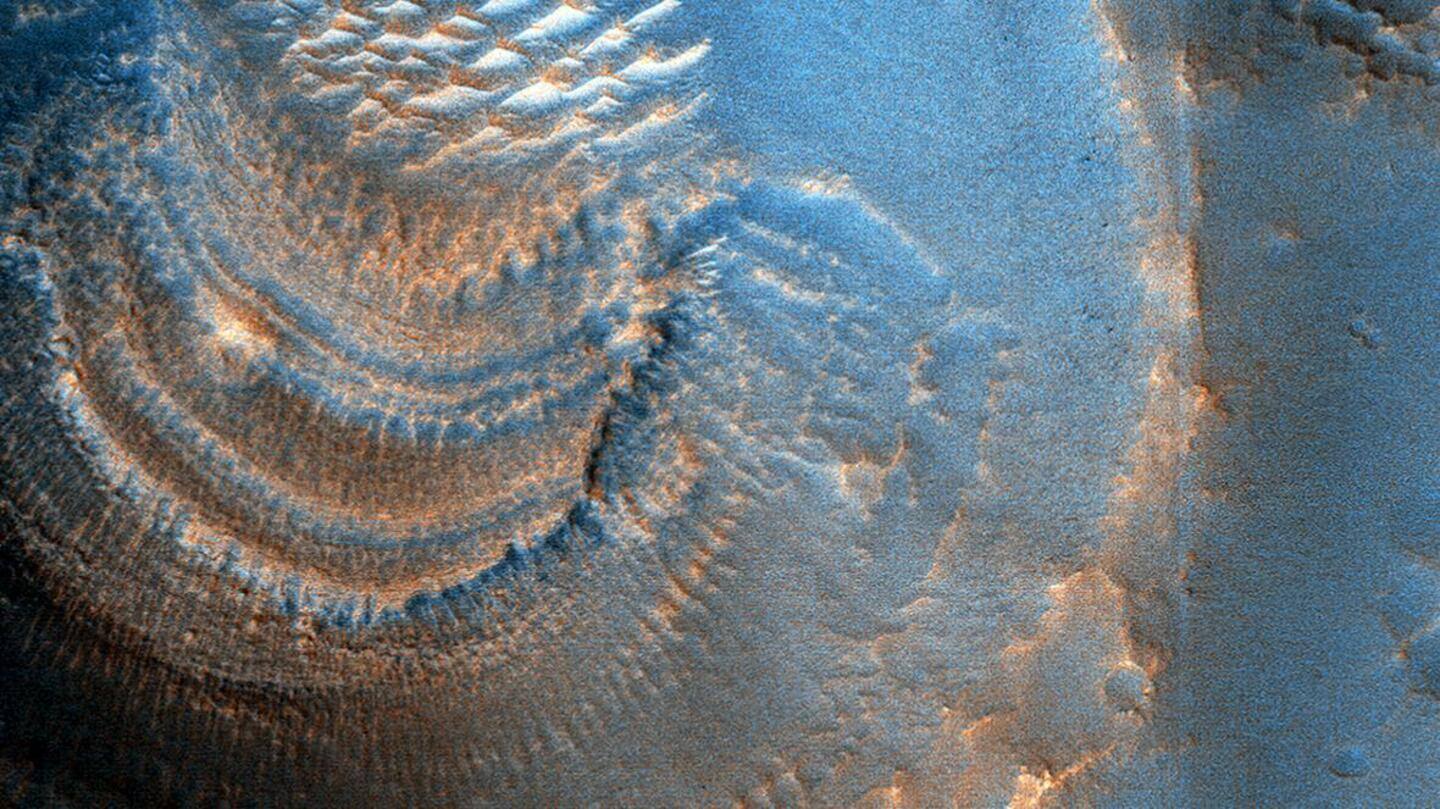
NASA's Mars Reconnaissance Orbiter has captured mysterious crater deposits in Arabia Terra, a region present in the northern regions of the red planet.
The image reveals that these craters contain 'curious deposits with strange shapes and distribution.'
The Orbiter snapped this picture from an altitude of 294.6km with the help of its HiRISE (High-Resolution Imaging Science Experiment) camera.
Context
Why does this story matter?
The Mars Reconnaissance Orbiter, which was launched in August 2005, carries the most powerful camera ever flown on a planetary exploration mission. Its primary objective is to provide a map of the Martian surface to help future missions.
It has also been probing for signs of water and has been collecting information about the climatic conditions on the red planet.
Image
The deposits were found in craters more than 600m wide
"The deposits have horizontal laminations that could be layers or terraces," wrote Paul Geissler, a researcher from the University of Arizona. The HiRise camera is controlled by researchers from this university.
It was discovered that the deposits have been found in craters that measure more than 600m wide. Smaller craters, which measure 450m wide or lesser do not have such deposits.
Details
The deposits appear on the southern side of the craters
The deposits only seem to appear on the south sides of craters that measure 600m in diameter. Small bright ridges were also found radiating from the deposits.
The image obtained from the HiRise camera has been processed and distinctive colors have been used to point to the formations and features of a crater with the unusual deposits inside it.
Reason
What was the cause of these deposits?
A possible explanation is that the deposits in the crater are associated with the sublimation (a process where a solid substance directly turns into gas) of ice-rich material on Mars.
"The terraces might represent different epochs of sublimation," explained Geissler. "Perhaps the larger craters penetrated to a water table between 45-60m below the surface and were flooded after formation."