NASA releases painting-like maps of Mars: Why are they important
What's the story
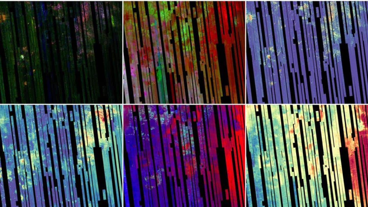
The Planetary Data System of the National Aeronautics and Space Administration (NASA) has released parts of a multicolored Martian map that look like paintings.
The 5.6-gigapixel map produced by the Compact Reconnaissance Imaging Spectrometer for Mars (CRISM) covers 86% of the planet's surface and shows the key minerals found there.
It will be released in batches to the public over the next six months.
Context
Why does this story matter?
Scientists will have a detailed look at the mineral distribution on Mars thanks to the new map. This will aid them in prioritizing regions that require an in-depth study.
The pictures are of the Nili Fossae region of Mars and the different colors represent minerals seen in different wavelengths of light.
One last map focusing only on iron-bearing minerals will also be released.
Complexity
Each piece of the map comprises 51,000 images
The first piece of this new map comprises 51,000 pictures. Each of them represents a 540km long and 10km wide 'strip.'
It has a lesser resolution compared to CRISM maps made from targeted observations. This is because the instrument was looking straight down to cover a wider area on the planet.
CRISM used two spectrometers to detect the wavelengths of reflected solar infrared light.
Utility
CRISM maps are also used for selecting landing sites
For 16 years, NASA's Mars Reconnaissance Orbiter (MRO) has used the CRISM to map minerals on the planet.
Its previously produced high-resolution mineral maps show how the crust was formed and the effect of water on it billions of years ago.
CRISM's maps have also been used to select landing sites for NASA's Perseverance rover in the Jezero Crater.
Information
'Map analysis will provide insight into Martian history'
MRO mission's project scientist at NASA, Richard Zurek hailed the importance of the mission. "The CRISM investigation has been one of the crown jewels of NASA's MRO mission. Analyses based on these final maps will provide insights into the history of Mars for years."