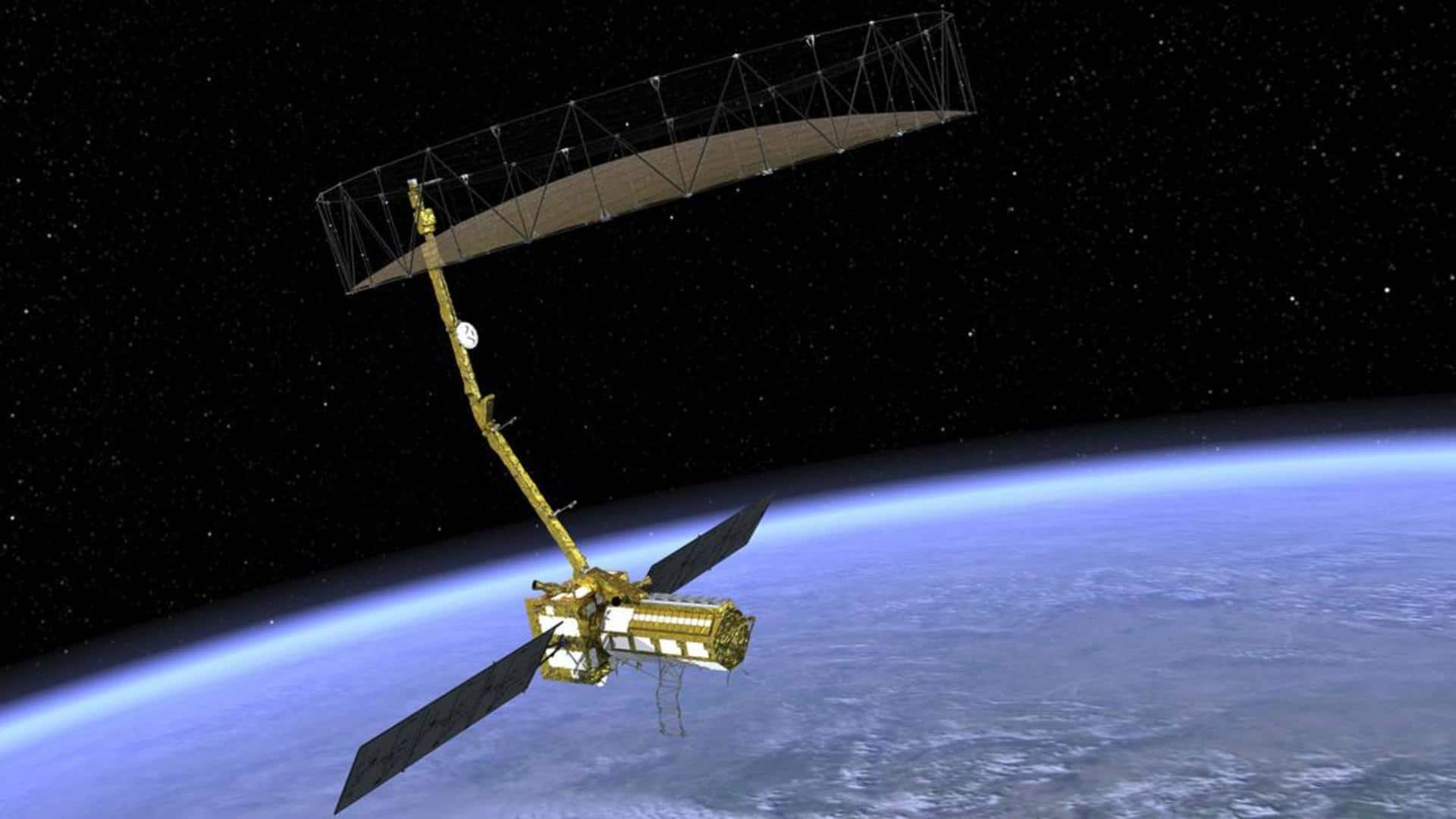
How ISRO will launch the world's most expensive Earth-imaging satellite
What's the story
ISRO will launch NISAR (NASA-ISRO Synthetic Aperture Radar), touted as the world's most expensive Earth-imaging satellite, in January 2024. It is estimated to cost around $1.5 billion. On March 8, a US Air Force C-17 aircraft brought the satellite's payload to India. The 14,000-km final journey of the SUV-sized payload marks a key milestone for the joint mission.
Context
Why does this story matter?
Launch
NISAR is expected to take off in January 2024
NISAR will take off from the Satish Dhawan Space Centre in Sriharikota, India into a near-polar orbit on ISRO's GSLV expendable launch vehicle. The mission, which will take off in January 2024, is set for three years. The first 90 days preceding the launch will be allocated for in-orbit checkout (IOC), where the observatory will be prepared for science observations.
Working
NISAR can map the whole globe in 12 days
NISAR will be the first radar of its kind to map Earth using two microwave bandwidth regions called L-band and S-band. The L and S dual band Synthetic Aperture Radar (SAR) payloads will be mounted on Integrated Radar Instrument Structure (IRIS) which together comprise the observatory. It can map the whole globe in 12 days and can detect changes under one centimeter across.
Collab
What are the contributions from NASA and ISRO?
ISRO will supply the S-Band SAR payload, the satellite bus, and the launch vehicle (GSLV Mk II). It will be responsible for heading the associated launch services. NASA will provide the L-Band SAR payload system and the engineering payloads for the mission, which include a Payload Data Subsystem, High-rate Science Downlink System, GPS receivers, and a Solid State Recorder.
Mission
NISAR can also spot warning signs of imminent volcanic eruptions
As per NASA, NISAR will monitor "Earth's changing ecosystems, dynamic surfaces, and ice masses providing information about biomass, natural hazards, sea level rise, and groundwater." The satellite can also "spot warning signs of imminent volcanic eruptions, help to monitor groundwater supplies, track the melt rate of ice sheets tied to sea level rise, and observe shifts in the distribution of vegetation around the world."