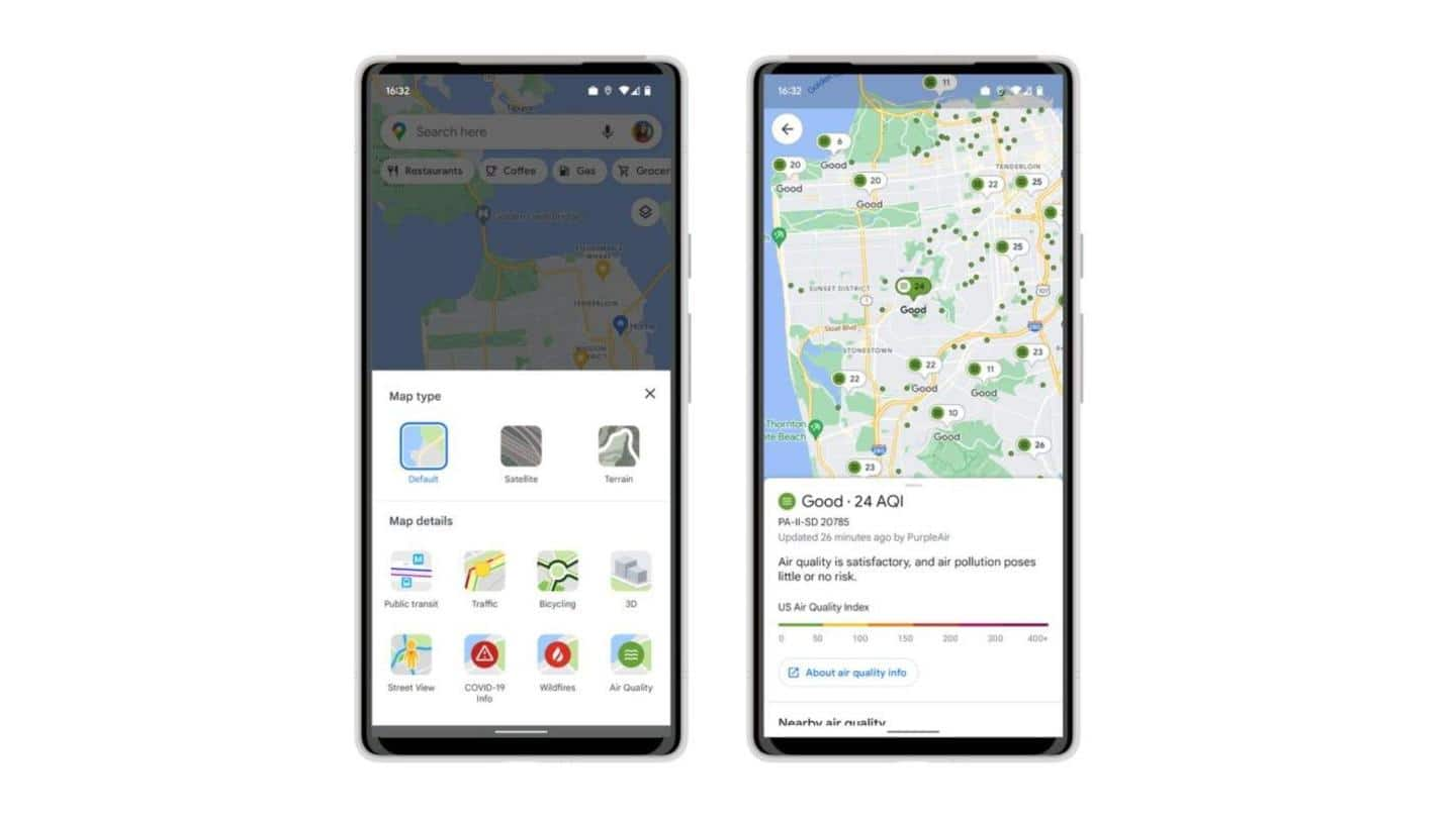
New Google Map feature shows air quality index around you
What's the story
Ever wondered what the quality of the air around you is? Well, Google Maps has come to your rescue with a new air quality layer.
The new feature will show the Air Quality Index (AQI) rating of the area you are in, along with guidance for outdoor activities.
It is available for both Android and iOS users but presently only in the US.
Context
Why does this story matter?
The World Health Organization says that 99% of the global population breathes air that WHO guideline limits and has high levels of pollutants.
But how can we know the quality of the air we breathe in real-time? Google's newly added air quality layer seems to be the answer for that.
Now, we can take into consideration Air Quality Index while planning an outdoor picnic.
Feature
Air Quality Index ranges from 0 to 400+
Google had first announced the addition of an air quality layer in Maps back in 2021. However, the integration was delayed due to unknown factors.
The new feature will show users the Air Quality Index of a particular area, ranging from zero to 400+.
As the wildfire season is approaching in the US, Google has also added a Wildfire layer to Maps.
How to
Click on the layers button to access air quality feature
To access air quality ratings in Maps, tap the rectangular 'layers' button on the right corner below the carousel of suggestions.
In the 'Map details' window that pops up, select the green air quality icon in the bottom-right corner.
You will be zoomed out once you enter the air quality layer. Click on any of the color-coded pins or dots to get more details.
Sources
Google has partnered with government agencies for the data
The data used in the making of the air quality layer comes from government agencies like the Environmental Protection Agency (EPA) and low-cost, hyper-local air quality data provider, PurpleAir.
Google has partnered with National Interagency Fire Center (NIFC) to provide details on wildfires in the US.
The company will soon add smoke data across the country from the National Oceanic and Atmospheric Administration (NOAA).