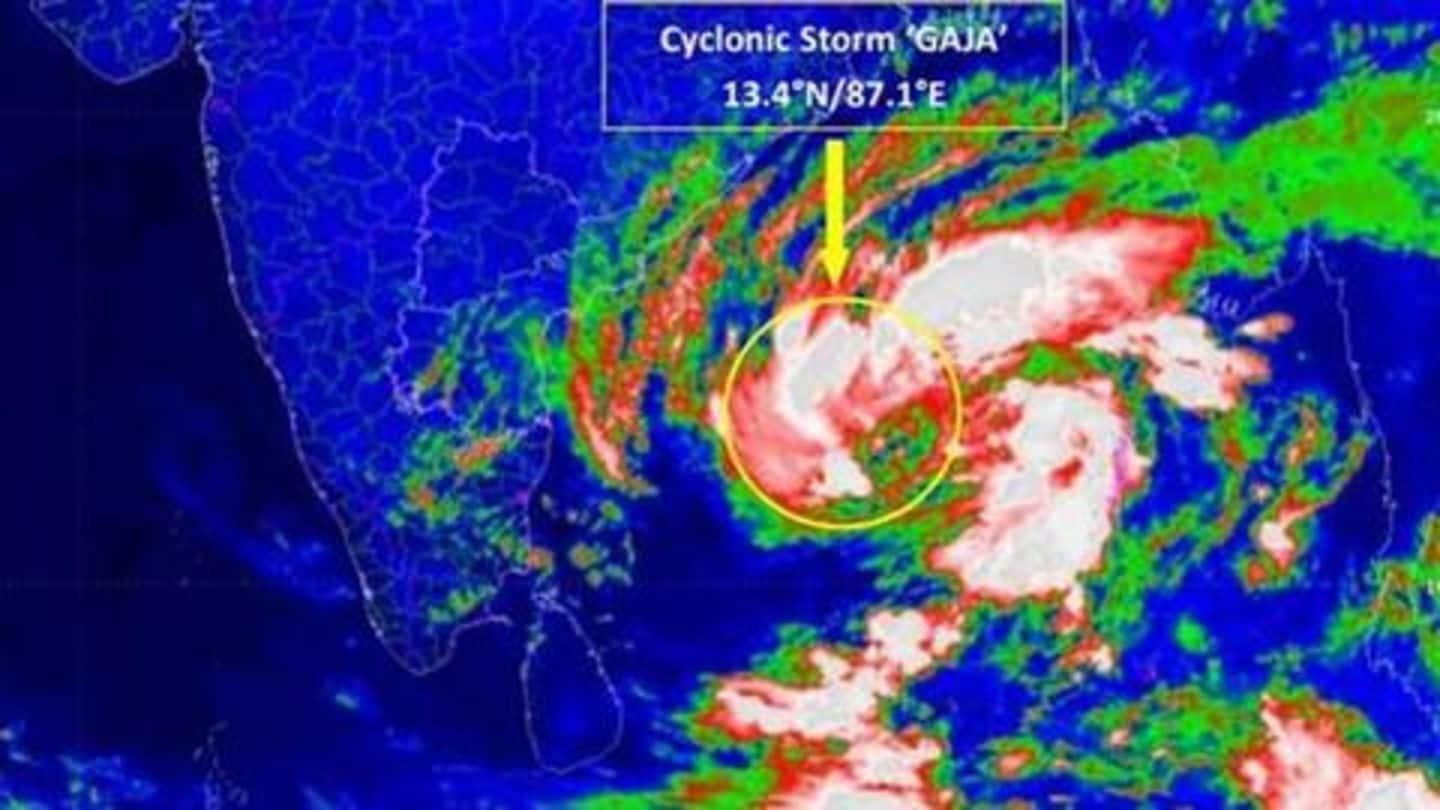
'Severe' cyclonic storm Gaja headed towards Tamil Nadu: Details here
What's the story
A 'severe' cyclonic storm, dubbed 'Gaja', is headed towards Tamil Nadu and Puducherry and is expected to make landfall on November 15.
The India Meteorological Department (IMD) has predicted heavy to very heavy rainfall in several coastal areas, and has advised a total suspension of fishing activities along and off the coastlines of north Tamil Nadu, Puducherry, and southern Andhra Pradesh.
Here's more.
Predictions
Extreme rainfall, 100kmph winds are expected in certain districts
According to the IMD, Cyclone Gaja is expected to intensify over the next 24 hours, and extremely heavy rainfall is expected over the districts of Cuddalore, Nagappattinam, Tiruvarur, Thanjavur, Pudukkottai, Tuticorin and Ramanathapuram from the night of November 14.
Winds of 80-110kmph can also be expected when Cyclone Gaja makes landfall.
The IMD has also warned of major damage to thatched huts/houses.
Inundation
Low-lying areas are expected to be inundated
When Gaja makes landfall, storm surges of height 1 meter are expected to inundate low-lying areas in the districts of Nagappattinam, Thanjavur, Pudukkottai and Ramanathapuram in Tamil Nadu, and the district of Karaikal in Puducherry.
In Tamil Nadu itself, a total of 4,399 locations have been identified as vulnerable, and over 30,000 rescue personnel have been kept on stand-by as a contingency.
The emergency number for Tamil Nadu is 1077.
Twitter Post
The NDMA's guidelines to weather the storm
#CycloneGaja #TamilNadu #AndhraPradesh pic.twitter.com/odkiogPx7D
— NDMA India (@ndmaindia) November 13, 2018
Other details
Downpours expected in Kerala, western Tamil Nadu too
However, Gaja is expected to weaken significantly after it makes landfall, and damaging winds are unlikely to affect western Tamil Nadu and Kerala.
That said, lingering moisture in the air is expected to spark daily showers and thunderstorms in Tamil Nadu and Kerala over the weekend, thereby giving rise to a risk of flash floods and mudslides in areas with rugged terrain.