Kerala floods: NASA's before-and-after images reveal scale of devastation
What's the story
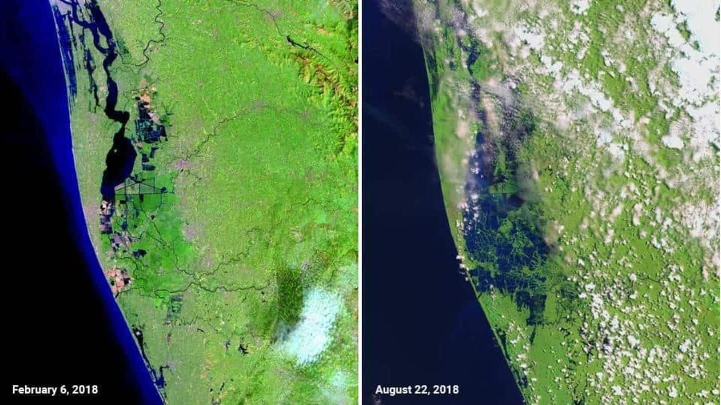
After releasing satellite measurements explaining the role of the Western Ghats in the Kerala floods, NASA has now released imagery that, in vivid detail, shows the devastation suffered by Kerala during the floods. The images, presented in a "before" and "after" format, show large swathes of land in Kerala still submerged under flood waters. Here are the details.
Details
Details of the before and after images
The "before" image was taken by NASA's earth observation satellite, Landsat 8's operational land imager on February 6, 2018. Meanwhile, the "after" image, dated August 22, was taken by the European Space Agency's (ESA) Sentinel-2 satellite last Wednesday. As expected, the floods starkly changed Kerala's landscape, submerging large swathes of land. The green in the images represent land, while blue represents water.
Devastation
The magnitude of devastation is mind-blowing
In the "after" image, the magnitude of flood-induced devastation in Kerala can be clearly seen. The image shows the districts of Pathanamthitta, Alappuzha, and Kottayam submerged in a sea of blue. A huge chunk of land south of the Vembanad Lake is also seen to be completely underwater in the image dated August 22.
Current situation
Over 4.5 lakh people continue to languish in relief camps
Meanwhile, the flood-ravaged state of Kerala, which saw over 300 people perish in the rains and the floods since August 8, is struggling to recover. Currently, over 4.5 lakh people remain lodged in 1,435 flood relief camps across the state, while clean-up and reconstruction activities are underway. As for damages, CM Pinarayi Vijayan, in a recent statement, said estimated losses were over Rs. 20,000cr.