Threat of 2 cyclones looms over Bay of Bengal: IMD
What's the story
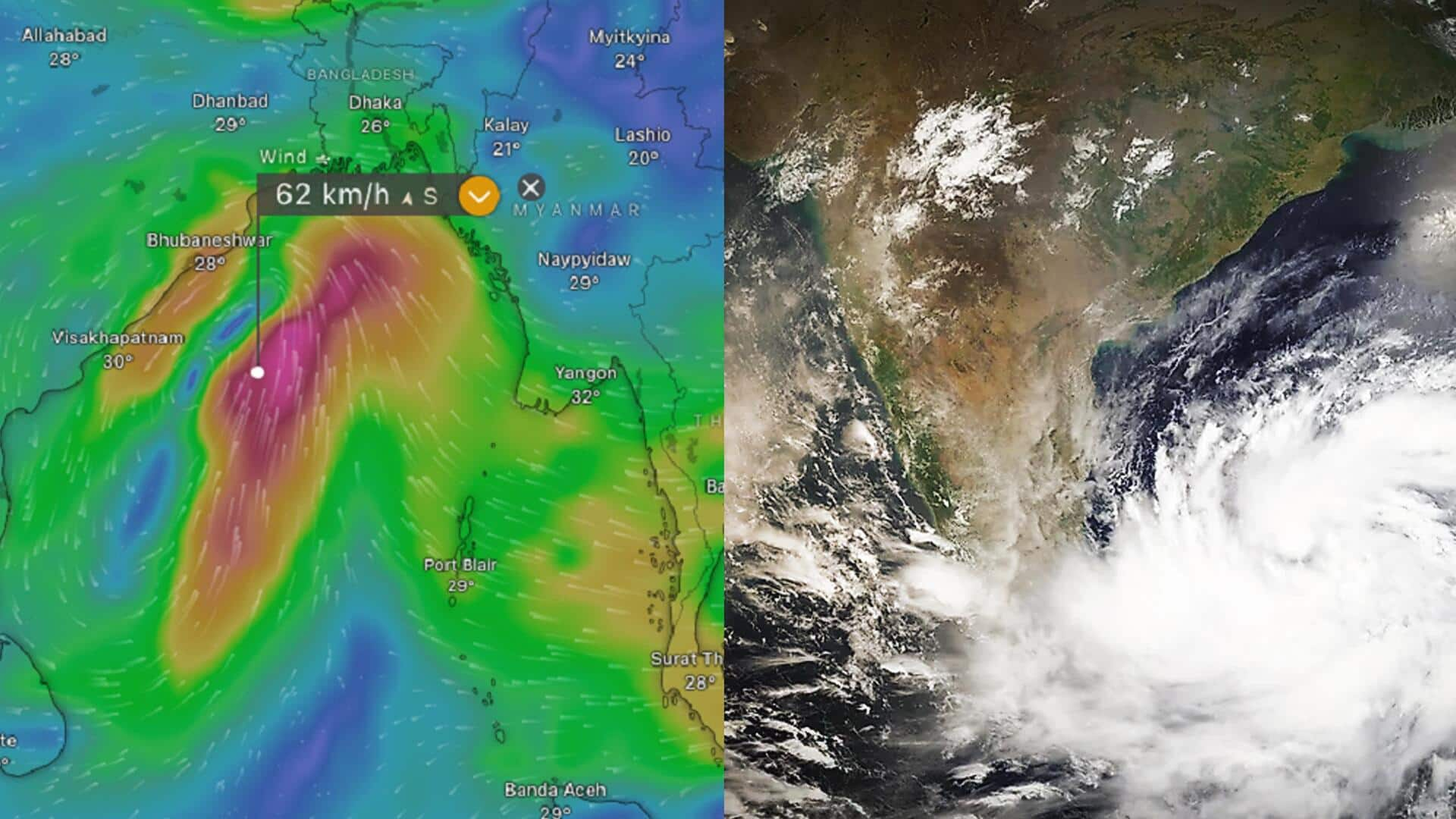
The India Meteorological Department (IMD) has predicted that two low-pressure systems in the Bay of Bengal could potentially escalate into cyclones. It also forecasted heavy rainfall in the coastal areas of Odisha and strong winds along and off the coast of Andhra Pradesh. Per IMD officials, the first low-pressure system has already formed over the South Andaman Sea on Tuesday, which will likely intensify into a depression in the West Central Bay of Bengal on Thursday.
Context
Why does this story matter?
This comes nearly a month after the country witnessed a rare twin cyclone threat in October—a phenomenon that was last witnessed in 2018. While Cyclone Tej developed into a "severe cyclonic storm" in the Arabian Sea on October 22, Cyclone Hamoon hit the Bay of Bengal after a few days. The low-pressure systems developing in the Bay of Bengal are likely to lead to torrential rains with higher wind speeds in coastal states like Odisha, Andhra Pradesh, and West Bengal.
Details
Second low-pressure area and Fujiwhara effect
The second system, an upper-air cyclonic circulation, has reportedly been detected over the Southwestern Bay of Bengal. A research scientist at the Typhoon Research Center of Jeju National University in South Korea, Vineet Kumar Singh, said this may generate a second low-pressure system, per Down to Earth. The interplay between them could trigger the "Fujiwhara effect," he said. It involves two nearby ocean storms engaging in a powerful dance around their shared center, per the US's National Weather Service (NWS).
Twitter Post
Low-pressure areas to intensify on Thursday: IMD scientist
#WATCH | Odisha: Senior Scientist of IMD Bhubaneswar Uma Shankar Das says, "Under the influence of yesterday's upper air circulation over the Andaman Sea adjoining southeast Bay of Bengal, a low-pressure area has formed over the same region that is Southeast adjoining Andaman sea… pic.twitter.com/rGG3U0XAUf
— ANI (@ANI) November 14, 2023
What Next?
Rapid intensification, difficulty in prediction
Singh also noted that the low-pressure system formed on Tuesday will likely progress into a depression on Wednesday and experience rapid intensification (RI). Rapid intensification occurs when a tropical cyclone's wind speeds increase by 56kmph or more within 24 hours, making predictions of the path and intensity of tropical cyclones difficult for weather agencies. Recent instances include Cyclone Freddy in February-March 2023 and Cyclone Biparjoy in June this year.
Insights
IMD advises fishermen not to venture into sea till Friday
Although the risk of the Fujiwhara effect is relatively low, consecutive cyclones could have a major impact along India's coastlines. The IMD said when the first low-pressure area intensifies into a depression and becomes a cyclonic storm, it will be called "Midhili," News18 reported It also advised fishermen not to venture into the sea from Wednesday to Friday. A few coastal districts of Odisha will likely receive light to moderate rainfall on Wednesday and isolated very heavy rainfall on Thursday.