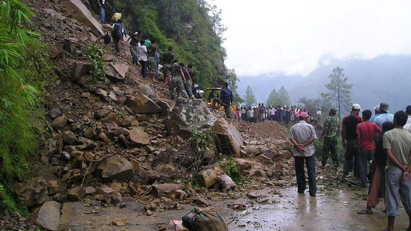
Landslides in Manipur are mostly 'anthropogenically' induced: Environment Ministry
What's the story
Every year, during monsoon, landslides claim a number of lives in Manipur, which has already witnessed six major landslides this year.
Most landslides in Manipur were "anthropogenically" induced and caused due to a host of reasons, including modification of slopes for construction and widening of roads, the Environment Ministry indicated.
Manipur witnessed three massive landslides in 2017, one in 2015, and four in 2010.
Landslides
Frequent landslides in environmentally-sensitive hilly areas: Minister
Landslides in Manipur frequently occur in environmentally-sensitive hilly areas, Minister of State for Environment Mahesh Sharma said in Rajya Sabha.
Experts stressed there was an urgent need to clearly classify high-landslide prone regions in Manipur and update the reviews every decade.
They said there's a need to understand that deforestation, blasting, tunneling, and encroachments on drainage systems among others increase the potential for landslides.
Reasons
Landslides caused as result of construction, road widening, quarrying
"Studies have indicated that landslides in Manipur are mostly anthropogenically induced...as a result of modification of slopes for construction, widening of road, quarrying for the construction materials, fragile lithology, complex geological structures and heavy rainfall," Mahesh Sharma said.
The weathered sedimentary (shale) rocks of Disang formation and thick loose overburden deposits on valley dipping slopes are most vulnerable for landslides in Manipur, he said.
Information
Major landslides in Manipur this year
The six massive landslides in Manipur this year occurred in Tamenglong in July, on NH-102 in East Imphal, NH 37 in Noney district, NH-102A in Ukhrul district and NH-37 in Noney district in June and on NH-37 near Makru bridge in Tamenglong district in May.
Government
Govt promotes, supports research studies relating to landslides: Sharma
The government promotes and supports research studies relating to landslides with remote sensing and Geographic Information System (GIS)-based mapping for proper management of landslide-sensitive zones, Sharma said in a written reply in the Upper House.
"These landslide studies are carried out as per the laid-down framework of Standard Operating Procedures (SOPs) for Landslide Disaster Management Plan of the GSI," he said.
Information
GSI engaged in various landslide monitory-related activities
GSI is actively engaged in carrying out landslide inventory mapping, national landslide susceptibility mapping (NLSM) on a 1:50,000 scale and 1:5,000 scale, and site-specific study of a landslide, including monitoring, to minimize environmental degradation, Sharma said.
Expert's statement
We should understand what increases landslide potential: An expert
"We need to clearly classify such highly landslide regions and also update the reviews...every decade. We should understand what increases the landslide potential," Himanshu Thakkar of South Asia Network on Dams, Rivers, and People (SANDRP), said.
The impact should be assessed whenever major interventions, in terms of roads, dams, hydropower projects, tunnels, blasting, deforestation, mining, are made in the landslide-prone areas, he said.